
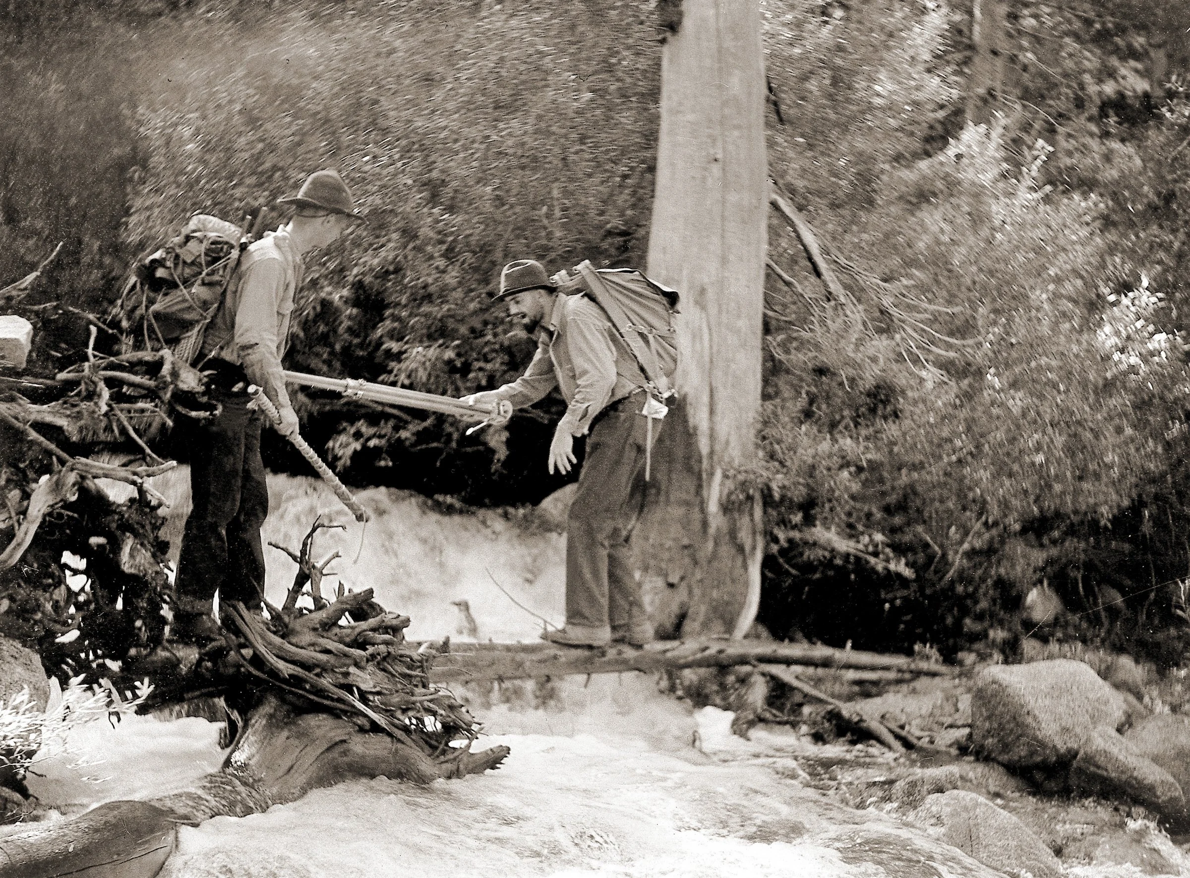
Ansel Adams using a tripod belay. Photo: Cedric Wright
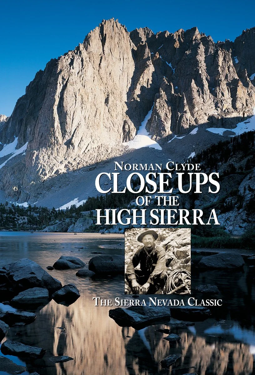
From Norman Clyde’s Sierra classic, Close Ups of the High Sierra
A Moment in Time — Remembering High & Wild: Essays and Photographs on Wilderness Adventure
I just learned of Robert Redford’s passing today. He was a gracious man, who cared about people, and loved the West. In the 1970s as an actor, Redford’s good looks and dry sense of perfectly timed humor, influenced a generation. He was a fine director with a great social conscience.
I was an art director for NBC Network when his headshots came across my desk for various specials. His was a face weathered by the outdoors and untouched by cosmetic surgery.
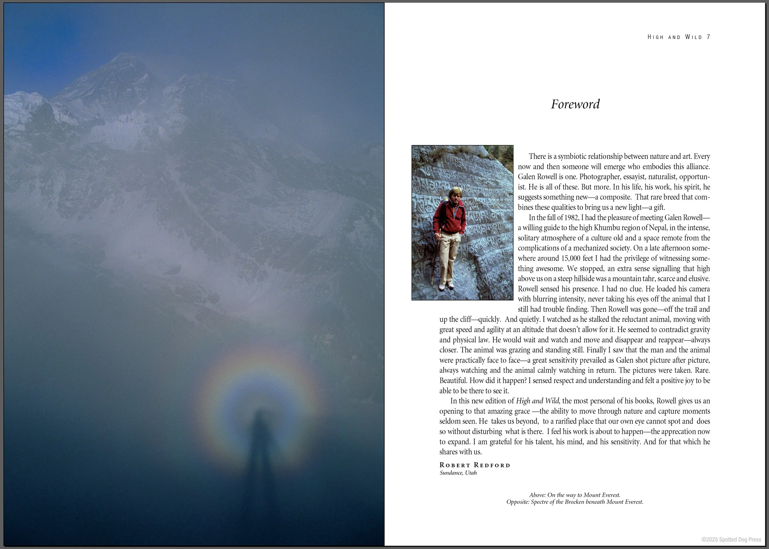
Redford wrote this foreword for his friend, Galen Rowell, whose book, High and Wild: Essays and Photographs on Wilderness Adventure, I published in 2002 (Spotted Dog Press). In August of that year, the book was at press in Shenzhen, China. Galen approved the color proofs, then he and Barbara Rowell left Bishop on a photography expedition, to the Arctic or Antarctic—I can’t remember which one. Galen said, “We’ll see you in three weeks.” That was the last time I saw him alive.
Three weeks later, a local pilot from Bishop picked up Galen and Barbara at SFO to bring them home. The plane never made it to the Bishop Airport. Just past midnight and short of the runway, we lost four people, Galen, Barbara, the pilot and the pilot’s guest.
Though High & Wild has been long out of print, I had to re-read Redford’s foreword this morning. On the opposite page is an image taken by Galen, on his and Redford’s 1982 month-long trek to Nepal. Entitled “Spectre of the Brocken beneath Mount Everest.” Galen's silhouette of a human figure, a portrait of himself holding a 35mm camera, encircled by a rainbow of light…representative of the Earth some say...with the Himalaya behind, was as if he was saying good-bye, but now I see them both. Just a moment in time.
— Wynne Benti, Publisher
September 16, 2025

Author Andy Zdon on Turtle Mountain in the Mojave Desert.
Traveling California and Southern Nevada,
summit to desert summit
Desert Summits: A Climbing and Hiking Guide to California and Southern Nevada covers an extensive area of the west, with driving and hiking directions to hundreds of author Zdon’s favorite desert summits, as well as a brief history of each area, from the Sweetwater Mountains of Eastern California to the Mojave Desert.
“The Mojave National Preserve covers more than 1.6 million acres, and has been referred to as the “Lonesome Triangle,” although on a holiday weekend, one will likely encounter more people than expected. The history of the region is tied closely to the two largest sources of water, the Colorado and Mojave Rivers. Native people are known to have inhabited the area as far back as 10,000 years ago, subsisting on the abundance of seeds and pinyon nuts in the area. About 700 years ago, Paiute-Shoshone people migrated to the region, and left behind evidence of their lifestyle through their ceremonial, camp, and village sites. The first known Europeans in the region were the Spanish explorers Juan Batista de Anza and Francisco Garces. They passed through the region during 1775 to 1776 via the Mojave River, passing by the Kelso Dunes and along the Providence and New York Mountains. Garces described in his diary: “I went four and one-half leagues to the east-southeast, having traveled through the big sand dunes and the Sierra de Santa Coleta.”
The Sierra de Santa Coleta was the name used for the Providence Mountains. Garces’ path probably took him through Cedar Canyon between the Mid Hills and Pinto Mountain. Fifty years passed before Jedediah Smith passed through the region on his way to southern California from the Rocky Mountains. John C. Fremont passed through the region in 1844 following the Spanish Trail which roughly followed the northern portion of the Mojave, and along the Mojave River. As early as 1846, Mormons on their way to southern California also used this route. A wagon route was established through the area in 1857, linking Prescott, Arizona with San Bernardino, California.
With the advent of this wagon road, prospecting in the region began in earnest. The late nineteenth century saw the establishment of many of the mining camps, that are today nothing but ghost towns or named sites marked upon a map. The first railroad to cross the Mojave did so in 1883. Soon, other rail lines crisscrossed the region. During the 1930’s, bigger and better topographic maps of the area became available, and exploration of the area for minerals, water resources (tapping into the Colorado) and other resources began to increase. Today the region is crossed by interstate highways, and continues to be traversed by trains. What was once a remote place to be avoided is now a vacationer’s paradise. Throughout the region, the hiker will encounter three main rock types: Paleozoic and Mesozoic-age sedimentary rocks consisting of limestone, dolomite and sandstone (e.g., at Mitchell Peak in the Providence Mountains); granitic rocks of the Teutonia quartz monzonite (e.g., at Teutonia Peak, New York Mountain, and the Granite Mountains); and Tertiary-age volcanic rocks including basalt and rhyolite tuff (as at Pinto Mountain, the Woods Mountains, and Fountain and Edgar Peaks). The variety of these rock types leads to the wide range of scenery in the area. In the Marble Mountains, a green shale called the “Latham shale” is one of the most fossiliferous units in the Mojave with fine specimens of trilobites occurring in its thinly-bedded horizons. The author has observed trilobite cephalons (the head of the trilobite) up to four inches in diameter…” Read more: Desert Summits: A Climbing and Hiking Guide to California and Southern Nevada
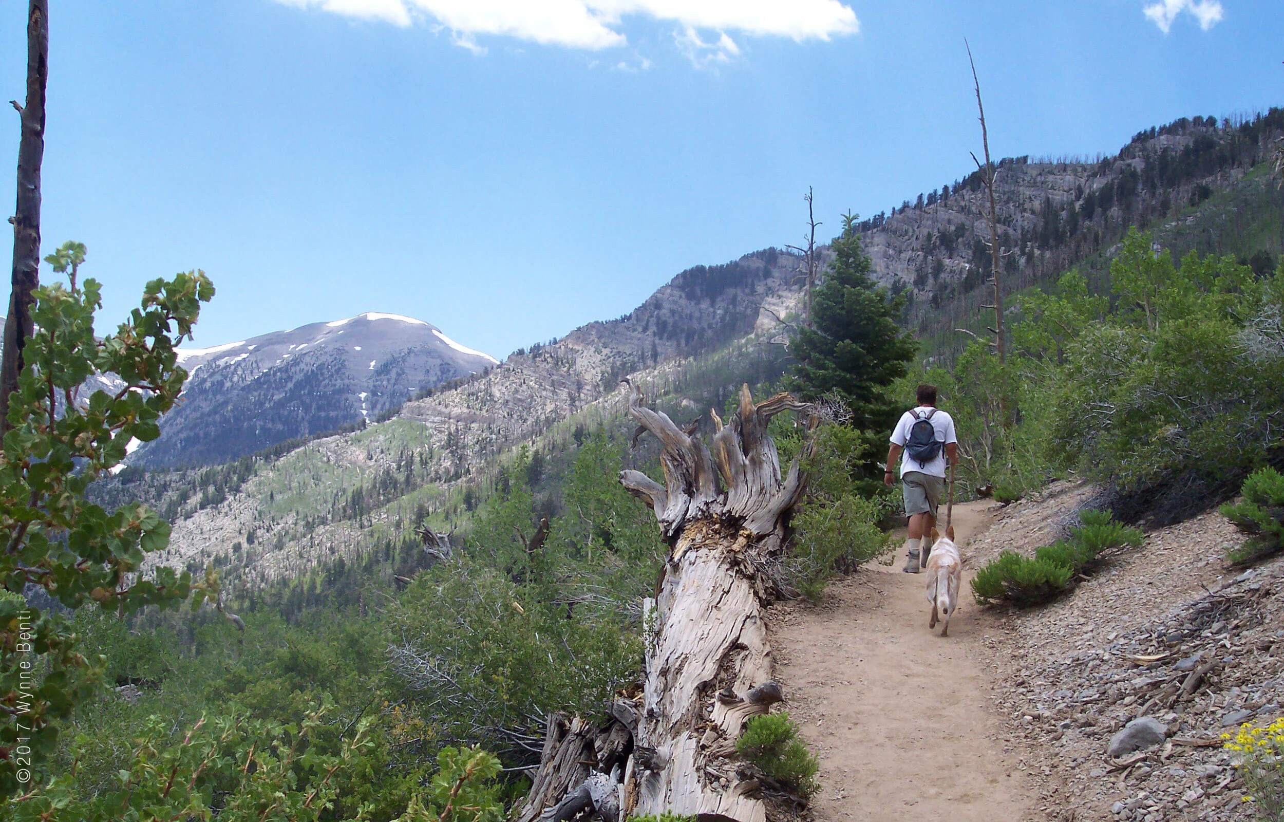
Round-trip to the summit of Mt. Charleston from Lee Canyon Ski Area (Photo: Wynne Benti)
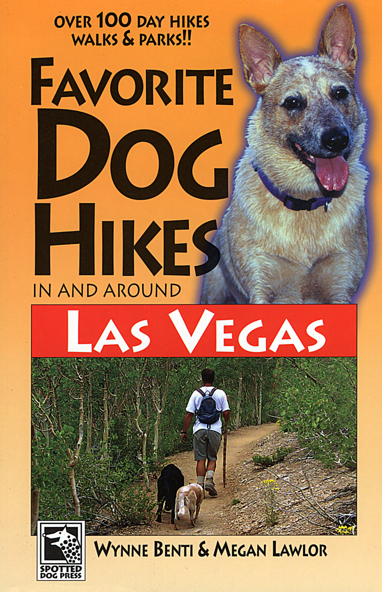
Favorite Dog Hikes In and Around
Las Vegas
From Mt. Charleston, Nevada's eighth highest peak, and the snow-filled gullies and waterfalls of the Spring Mountains, to the hidden springs of the Desert National Wildlife Refuge, this is the most comprehensive dog hiking guide to Las Vegas and its surrounding areas.
Fourth generation native Las Vegan, Megan Lawlor, has been hiking Las Vegas and its desert environs since she was a child. She knows Las Vegas for the great outdoor opportunities that abound in the area.
Wynne Benti authored, Favorite Dog Hikes in and Around Los Angeles, the first regional dog hiking guide book of its kind in the United States. Co-founder of the Sierra Club's K9 Hiking Committee in Los Angeles, Wynne has taught clinics at REI.
"Wynne Benti is one of the dog hiking pioneers." — BARK Magazine
Wynne has summited more than 1,200 peaks in Nevada, California, Utah, Arizona and Baja. She finished the Sierra Club’s Desert Peaks (#105) and Hundred Peaks (#264) lists.
More than 100 hikes, walks and summits:
Calico Basin
Desert National Wildlife Refuge
Mountain Springs
Pahranagat NWR
Spring Mountains
The Sheep Mountains
Red Rock NCA
Spring Mountain Ranch
Lake Mead NRA
Valley of Fire
Includes local history, tons of photographs, maps and a pattern for making your own dog hiking boots
Take a look at this gem of a book and begin planning a year’s worth of day or weekend trips in and around Nevada. I guarantee you’ll be pleasantly surprised.
— Nancy Gott, Adjunct Professor, UNLV
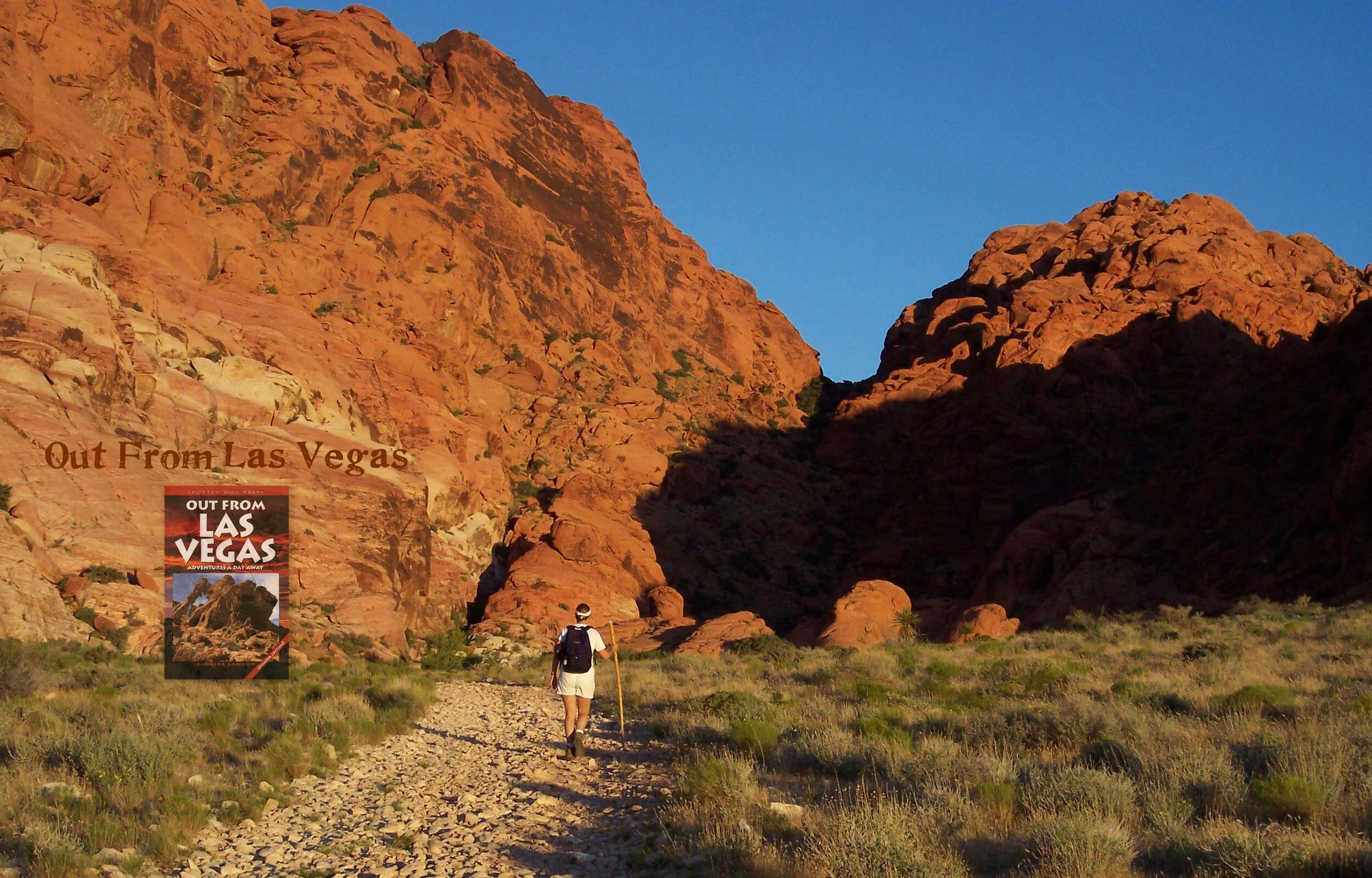
Out from Las Vegas: Adventures A Day Away